Digitale farbige Orthophotos 2015 (DOP20RGB)
| Type | wms |
|---|---|
| Title | Digitale farbige Orthophotos 2015 (DOP20RGB) |
| Category | Basiskarten/Luftbilder |
| Download | See individual layer for download link. |
| FisBroker-Link | http://fbinter.stadt-berlin.de/fb/index.jsp?loginkey=showMap&mapId=k_luftbild2015_rgb@senstadt |
| Keywords | Orthoimagery,Luftbild,open data,opendata,AdVMIS,Karten,Geodaten,Berlin,Luftbilder,Orthophotos,DOP,Topographie,Topografie,topographisch,topografisch,äöü |
| Beschreibung | |
| link | ?id=k_luftbild2015_rgb@senstadt&type=WMS |
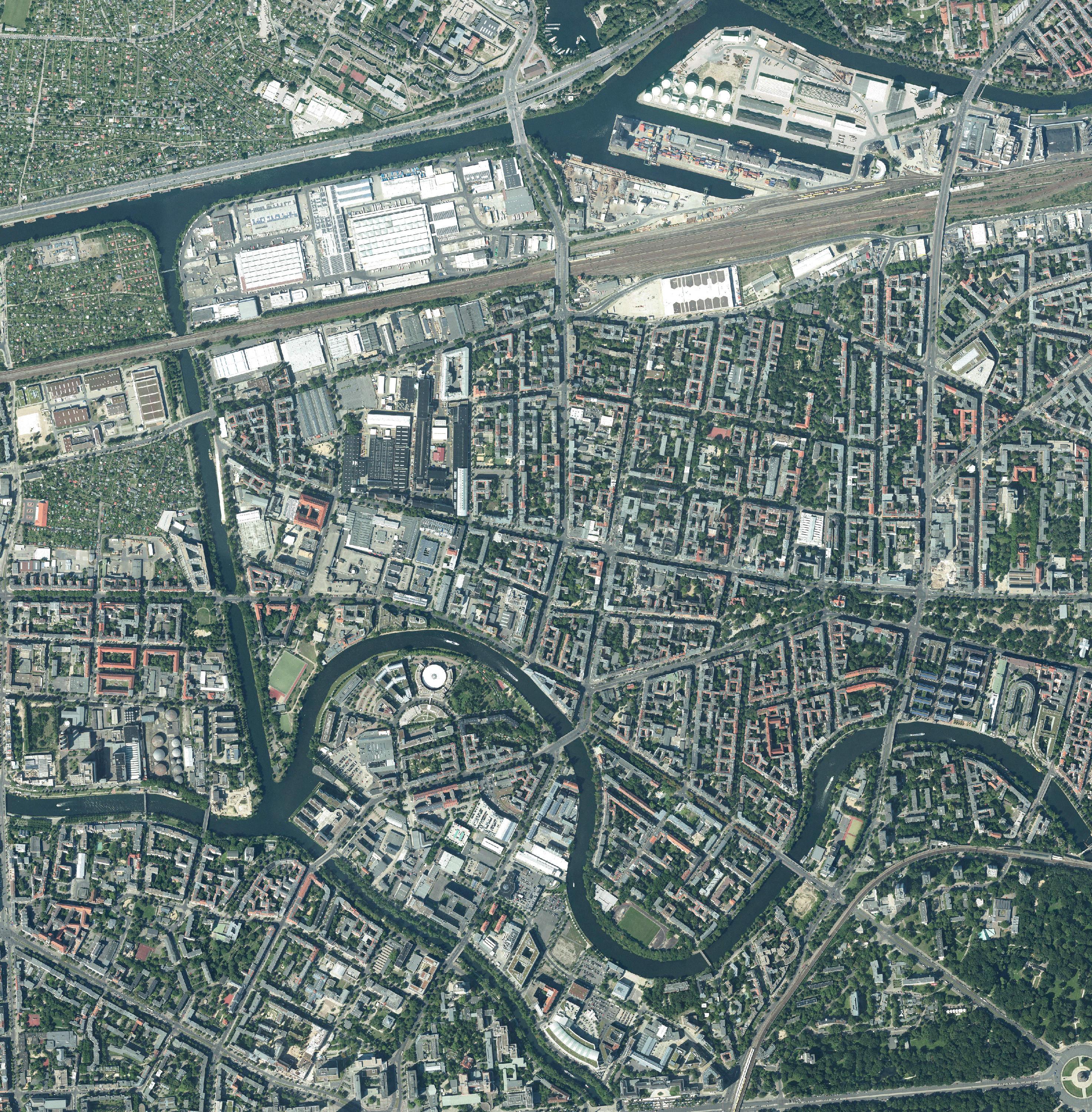
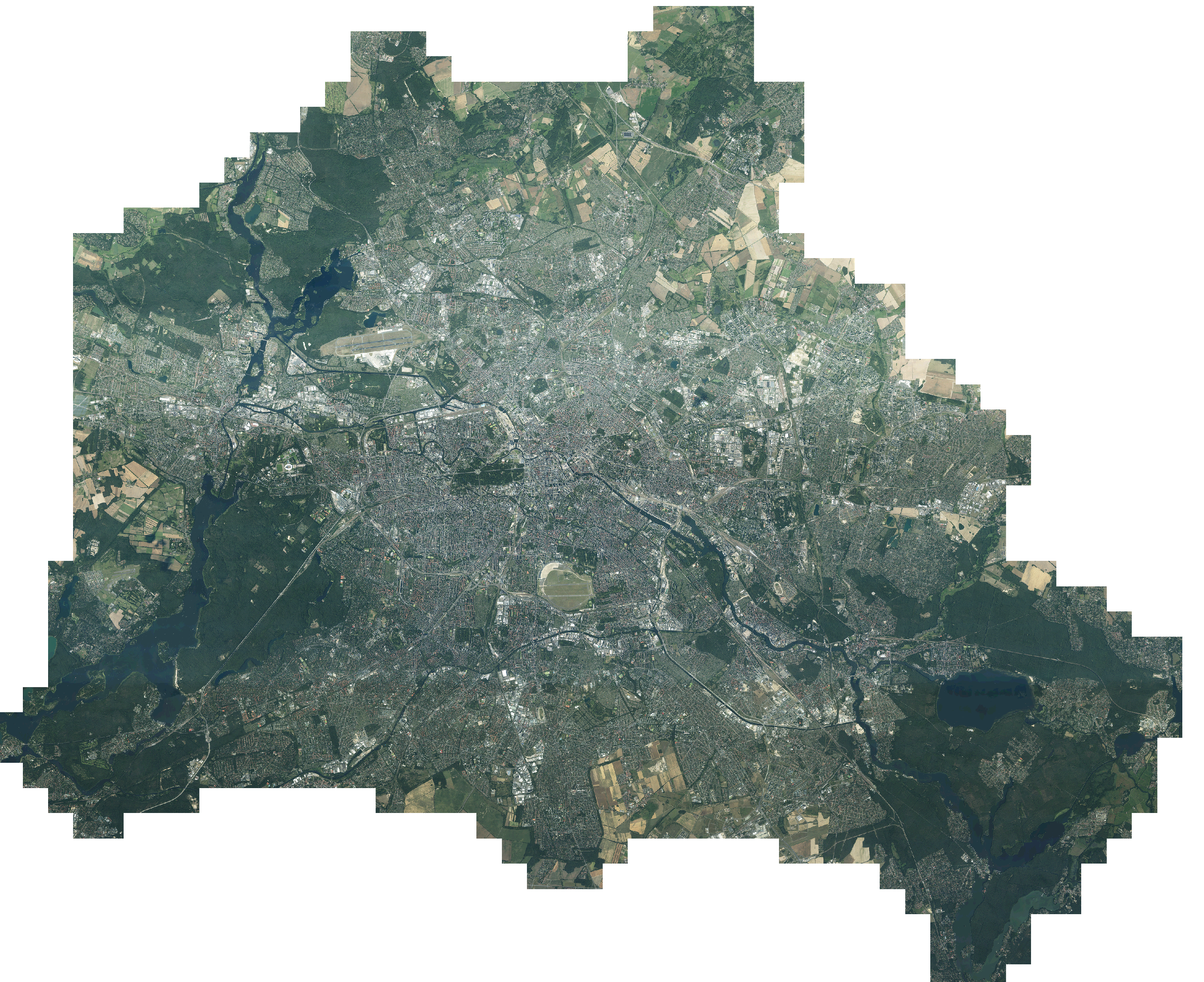
| kurzbeschreibung | Digitale Orthophotos für das gesamte Berliner Stadtgebiet mit einer Bodenauflösung von 0,20 m im Blattschnitt 2 km x 2 km. |
| koordinatensysteme | EPSG:25833, EPSG:25832, EPSG:3068, EPSG:4258 |
| ausdehnung | EPSG:25833: 369097,85, 5799298,14, 416865,04, 5838236,21 EPSG:25832: 777914,96, 5805397,1, 822326,52, 5848208,6 EPSG:3068: 2750,01, 250,01, 49780,01, 40100,01 EPSG:4258: 13,08, 52,33, 13,77, 52,69 |
| ebenen | Luftbilder 2015 (Orthophotos) |
| nutzungsbedingungen | Nutzungsbedingungen: Für die Verwendung der Daten gelten folgende Nutzungsbestimmungen: http://www.stadtentwicklung.berlin.de/geoinformation/download/nutzIII.pdf - Der Quellenvermerk gemäß §2 lautet "Geoportal Berlin / [Titel des Datensatzes]". |
| zugriffsbeschränkungen | Es gelten keine Bedingungen |
| beschreibung | Digitale Orthophotos für das gesamte Berliner Stadtgebiet mit einer Bodenauflösung von 0,20 m im Blattschnitt 2 km x 2 km. |
| Anbieter | |
| Adress | Senatsverwaltung für Stadtentwicklung und Umwelt Berlin Berlin Fehrbelliner Platz 1, 10707 Berlin |
| telefon | +49-30-90139-5257 |
| fax | +49-30-90139-5251 |
| fisbroker@senstadtum.berlin.de | |
| Technology | |
| standard | WMS |
| version | 1.0.0 1.1.0 1.1.1 1.3.0 |
| operationen | GetCapabilities GetMap GetFeatureInfo |
| grafikformate | image/jpeg image/png |
| rechneradresse | http://fbinter.stadt-berlin.de/fb/wms/senstadt/k_luftbild2015_rgb |
| legend | |
| Layers | |
| Luftbilder 2015 (Orthophotos) (ID: 0) | |
| Show Layer on Map | |
| Download | Moabit Karte Berlin Karte |
| Abstract | Digitale Orthophotos für das gesamte Berliner Stadtgebiet mit einer Bodenauflösung von 0,20 m im Blattschnitt 2 km x 2 km. |
| MetaData | http://fbinter.stadt-berlin.de/fb/csw?REQUEST=GetRecordById&SERVICE=CSW&VERSION=2.0.2&ID=0388b41b-74b9-3bbb-a578-c3ef0c884154&ELEMENTSETNAME=FULL |
| GDI ID | undefined |
| Style | Standard GDI Style (gdi_default) |
| Legend | http://fbinter.stadt-berlin.de/fb_daten/legenden/keine_legende.gif (72x72) |
| ScaleHint | 0-105 |
| Keywords | open data,opendata,AdVMIS,Karten,Geodaten,Berlin,Luftbilder,Orthophotos,DOP,Topographie,Topografie,topographisch,topografisch,äöü |
| BoundingBox | EPSG:25833 (5799298.1358,369097.8529,5838236.2097,416865.038) |
| BoundingBox | EPSG:25832 (5805397.0978,777914.9577,5848208.6,822326.5243) |
| BoundingBox | EPSG:3068 (250.0101,2750.0092,40100.01,49780.0092) |
| BoundingBox | EPSG:4258 (52.3284,13.079,52.6877,13.7701) |
| BoundingBox | EPSG:4326 (52.3284,13.079,52.6877,13.7701) |
