Biotoptypen (Umweltatlas)
| Type | wms |
|---|---|
| Title | Biotoptypen (Umweltatlas) |
| Category | Umweltatlas |
| Download | See individual layer for download link. |
| FisBroker-Link | http://fbinter.stadt-berlin.de/fb/index.jsp?loginkey=showMap&mapId=k_fb_berlinbtk@senstadt |
| Keywords | Bio-geographical regions,Habitats and biotopes,Species distribution,Biotop,Landschaftsplanung,Naturschutz,inspireidentifiziert,Karten,Geodaten,Berlin,Biotope,Biotopkartierung,Biotoptypenkartierung,Biotoptypenliste,Biotopwert,Biotopschutz,FFH,Lebensraumtypen,Naturhaushalt,Landschaft,Wälder,Forsten,Stadtgrün,wertvolle Lebensräume |
| Beschreibung | |
| link | ?id=k_fb_berlinbtk@senstadt&type=WMS |
| kurzbeschreibung | Flächendeckende Biotoptypenkarte Berlin, Basis: Gelände- und Luftbild-Kartierungen der Biotoptypen (Primärdaten) und Sekundärdaten - Umweltatlas Stadtstruktur, Grünflächen-, Friedhofs- und Kleingartenkataster, Gewässerkarte |
| koordinatensysteme | EPSG:25833, EPSG:3068, EPSG:31467, EPSG:25832, EPSG:4258 |
| ausdehnung | EPSG:25833: 367190,96, 5798934,34, 417447,14, 5838875,02 EPSG:3068: 850,01, -149,99, 50350,01, 40750,01 EPSG:31467: 3776226,16, 5806761,91, 3823055,14, 5850798,27 EPSG:25832: 776043,39, 5804876,22, 822854,06, 5848894,47 EPSG:4258: 13,05, 52,32, 13,78, 52,69 |
| ebenen | Biotope (Primärdaten) Biotope (Sekundärdaten) Straßennamen Gleise Grenzen Biotoptypen K5 ALK Biotopschlüssel BfN-Schlüssel |
| nutzungsbedingungen | Nutzungsbedingungen noch nicht abschließend formuliert |
| zugriffsbeschränkungen | Ressource unterliegt der jeweiligen Gesetzgebung zum Urheberrecht Ressource unterliegt lizenzrechtlichen Bestimmungen Ressource unterliegt der jeweiligen Gesetzgebung zum Schutz des geistigen Eigentums |
| beschreibung | Flächendeckende Biotoptypenkarte Berlin, Basis: Gelände- und Luftbild-Kartierungen der Biotoptypen (Primärdaten) und Sekundärdaten - Umweltatlas Stadtstruktur, Grünflächen-, Friedhofs- und Kleingartenkataster, Gewässerkarte |
| Anbieter | |
| Adress | Senatsverwaltung für Stadtentwicklung und Umwelt Berlin Berlin Fehrbelliner Platz 1, 10707 Berlin |
| telefon | +49-30-90139-5257 |
| fax | +49-30-90139-5251 |
| fisbroker@senstadtum.berlin.de | |
| Technology | |
| standard | WMS |
| version | 1.0.0 1.1.0 1.1.1 1.3.0 |
| operationen | GetCapabilities GetMap GetFeatureInfo |
| grafikformate | image/jpeg image/png |
| rechneradresse | http://fbinter.stadt-berlin.de/fb/wms/senstadt/k_fb_berlinbtk |
| legend | |
| Layers | |
| Biotope (Primärdaten) (ID: 0) | |
| Show Layer on Map | |
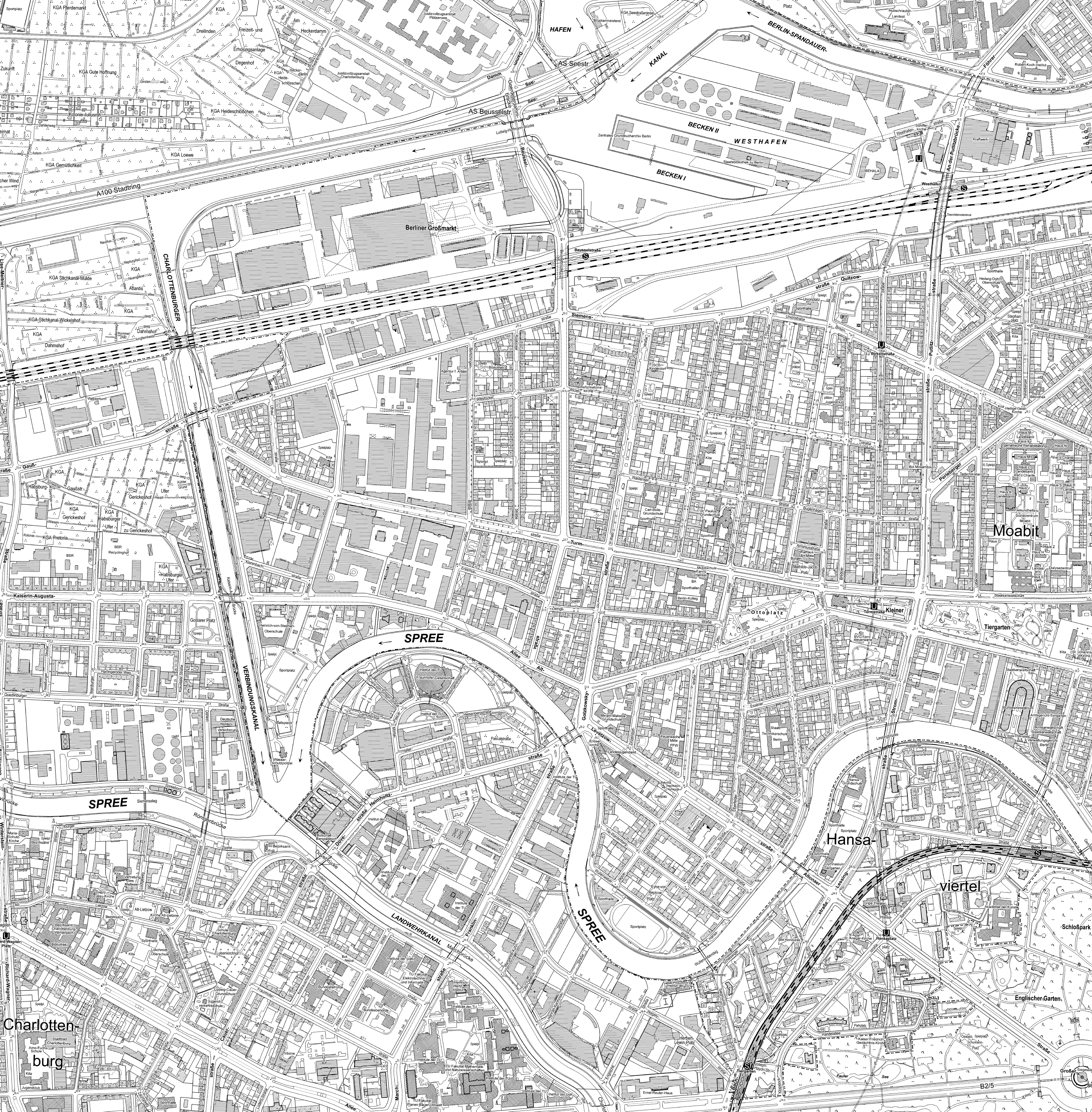
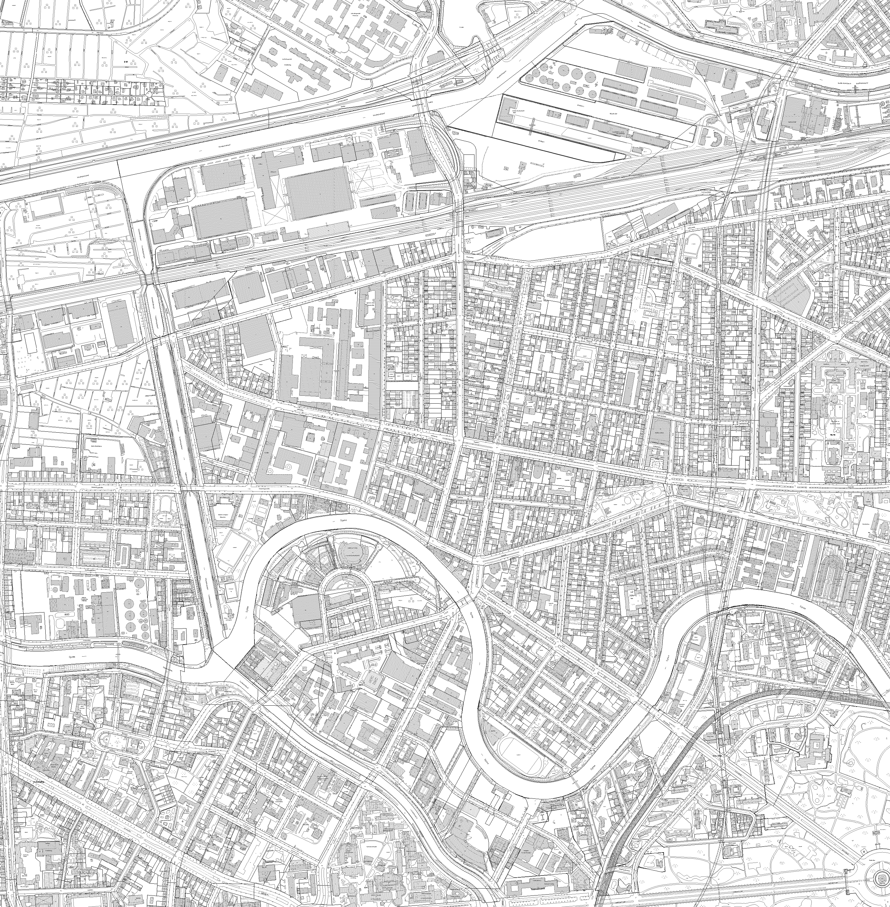
| Download | Moabit Karte Berlin Karte |
| Abstract | terrestrische Biotopkartierungen (Begehung der Flächen) und Luftbildauswertung |
| MetaData | http://fbinter.stadt-berlin.de/fb/csw?REQUEST=GetRecordById&SERVICE=CSW&VERSION=2.0.2&ID=52b39467-eb2a-3a0a-ae8a-2e34626745aa&ELEMENTSETNAME=FULL |
| GDI ID | undefined |
| Style | Standard GDI Style (gdi_default) |
| Legend | http://fbinter.stadt-berlin.de/fb_daten/legenden/umweltatlas/leg_fb_berlinbtk.gif (72x72) |
| ScaleHint | 0-499 |
| Keywords | inspireidentifiziert,Karten,Geodaten,Berlin,Biotope,Biotopkartierung,Biotoptypenkartierung,Biotoptypenliste,Biotopwert,Biotopschutz,FFH,Lebensraumtypen,Naturhaushalt,Landschaft,Wälder,Forsten,Stadtgrün,wertvolle Lebensräume |
| BoundingBox | EPSG:25833 (5798934.3364,367190.9604,5838875.0218,417447.1434) |
| BoundingBox | EPSG:3068 (-149.9899,850.0092,40750.01,50350.0091) |
| BoundingBox | EPSG:31467 (5806761.9082,3776226.1598,5850798.2686,3823055.1387) |
| BoundingBox | EPSG:25832 (5804876.2202,776043.3892,5848894.474,822854.0551) |
| BoundingBox | EPSG:4258 (52.3246,13.0512,52.6935,13.7785) |
| BoundingBox | EPSG:4326 (52.3246,13.0512,52.6935,13.7785) |
| Biotope (Sekundärdaten) (ID: 1) | |
| Show Layer on Map | |
| Download | Moabit Karte Berlin Karte |
| Abstract | Für einen Teil der Fläche Berlins wurden vorhandene Datenquellen genutzt und diese Daten in Biotoptypen umgeschlüsselt |
| MetaData | http://fbinter.stadt-berlin.de/fb/csw?REQUEST=GetRecordById&SERVICE=CSW&VERSION=2.0.2&ID=52b39467-eb2a-3a0a-ae8a-2e34626745aa&ELEMENTSETNAME=FULL |
| GDI ID | undefined |
| Style | Standard GDI Style (gdi_default) |
| Legend | http://fbinter.stadt-berlin.de/fb_daten/legenden/umweltatlas/leg_fb_berlinbtk.gif (72x72) |
| ScaleHint | 0-499 |
| Keywords | inspireidentifiziert,Karten,Geodaten,Berlin,Biotope,Biotopkartierung,Biotoptypenkartierung,Biotoptypenliste,Biotopwert,Biotopschutz,FFH,Lebensraumtypen,Naturhaushalt,Landschaft,Wälder,Forsten,Stadtgrün,wertvolle Lebensräume |
| BoundingBox | EPSG:25833 (5798934.3364,367190.9604,5838875.0218,417447.1434) |
| BoundingBox | EPSG:3068 (-149.9899,850.0092,40750.01,50350.0091) |
| BoundingBox | EPSG:31467 (5806761.9082,3776226.1598,5850798.2686,3823055.1387) |
| BoundingBox | EPSG:25832 (5804876.2202,776043.3892,5848894.474,822854.0551) |
| BoundingBox | EPSG:4258 (52.3246,13.0512,52.6935,13.7785) |
| BoundingBox | EPSG:4326 (52.3246,13.0512,52.6935,13.7785) |
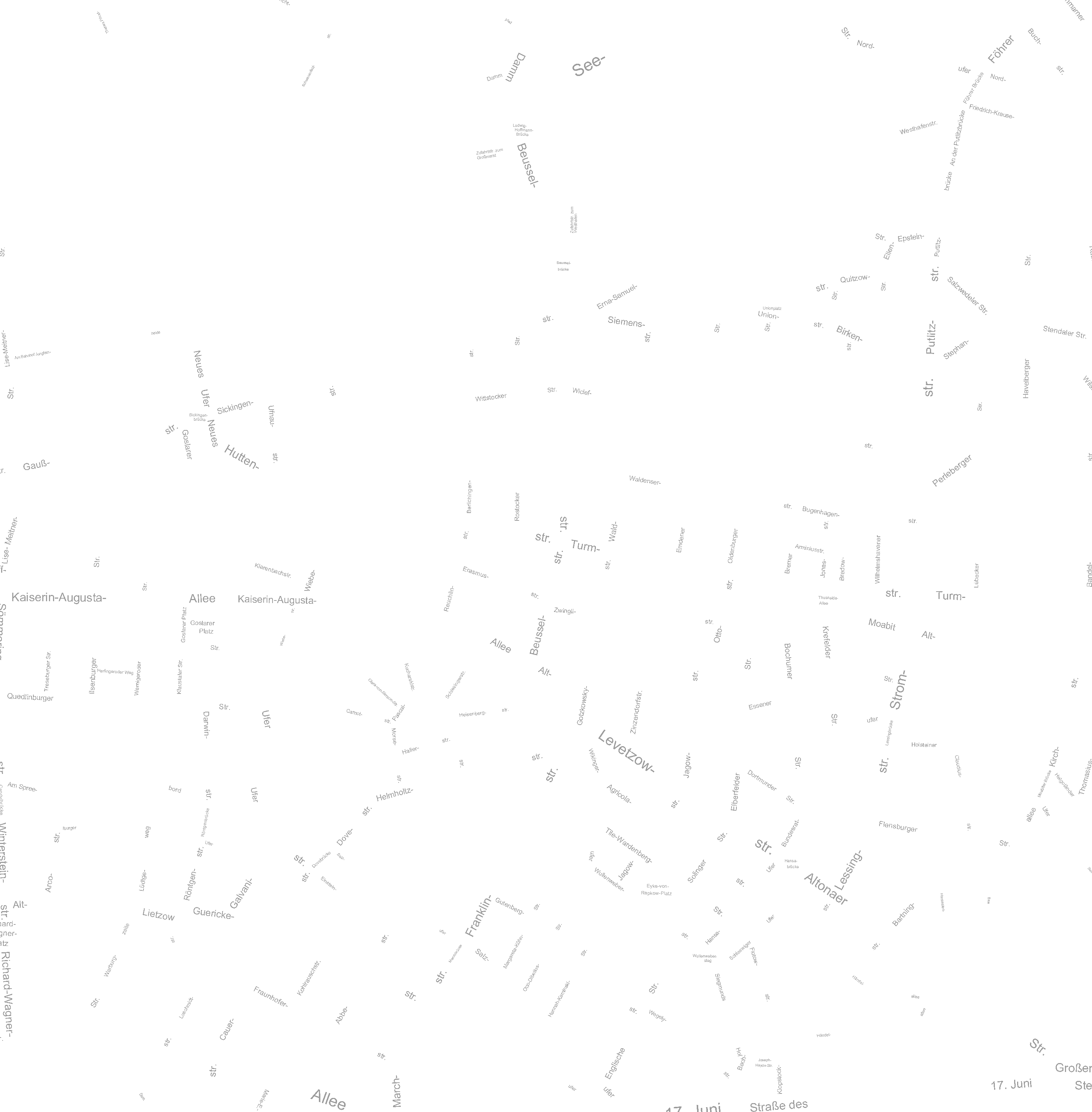
| Straßennamen (ID: 2) | |
| Show Layer on Map | |
| Download | Moabit Karte Berlin Karte |
| Abstract | Straßennamen von Berlin |
| MetaData | http://fbinter.stadt-berlin.de/fb/csw?REQUEST=GetRecordById&SERVICE=CSW&VERSION=2.0.2&ID=52b39467-eb2a-3a0a-ae8a-2e34626745aa&ELEMENTSETNAME=FULL |
| GDI ID | undefined |
| Style | Standard GDI Style (gdi_default) |
| Legend | http://fbinter.stadt-berlin.de/fb/wms/legend/senstadt/k_fb_berlinbtk?layerID=2 (300x300) |
| ScaleHint | 0-499 |
| Keywords | inspireidentifiziert,Karten,Geodaten,Berlin,Biotope,Biotopkartierung,Biotoptypenkartierung,Biotoptypenliste,Biotopwert,Biotopschutz,FFH,Lebensraumtypen,Naturhaushalt,Landschaft,Wälder,Forsten,Stadtgrün,wertvolle Lebensräume |
| BoundingBox | EPSG:25833 (5798934.3364,367190.9604,5838875.0218,417447.1434) |
| BoundingBox | EPSG:3068 (-149.9899,850.0092,40750.01,50350.0091) |
| BoundingBox | EPSG:31467 (5806761.9082,3776226.1598,5850798.2686,3823055.1387) |
| BoundingBox | EPSG:25832 (5804876.2202,776043.3892,5848894.474,822854.0551) |
| BoundingBox | EPSG:4258 (52.3246,13.0512,52.6935,13.7785) |
| BoundingBox | EPSG:4326 (52.3246,13.0512,52.6935,13.7785) |
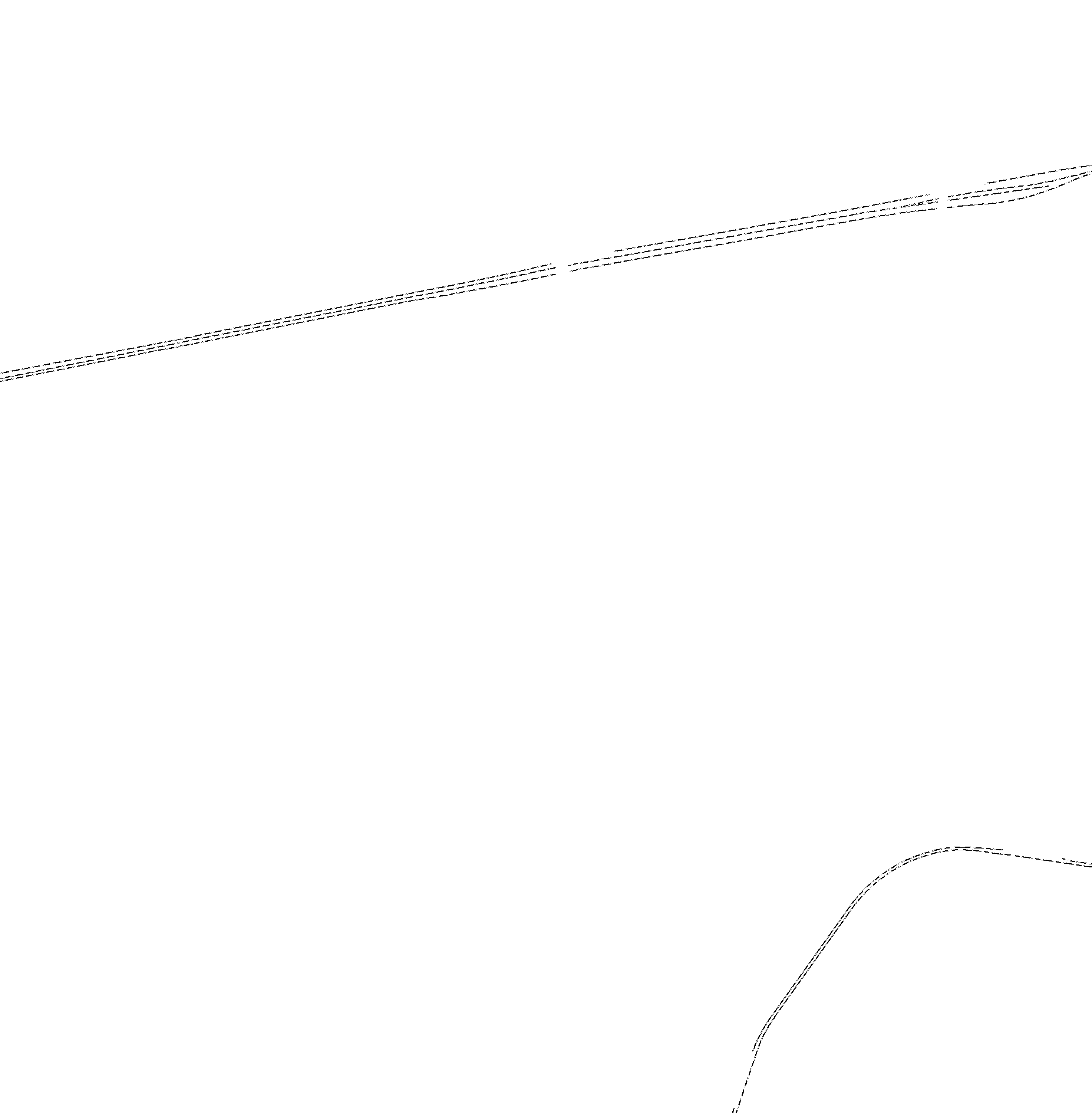
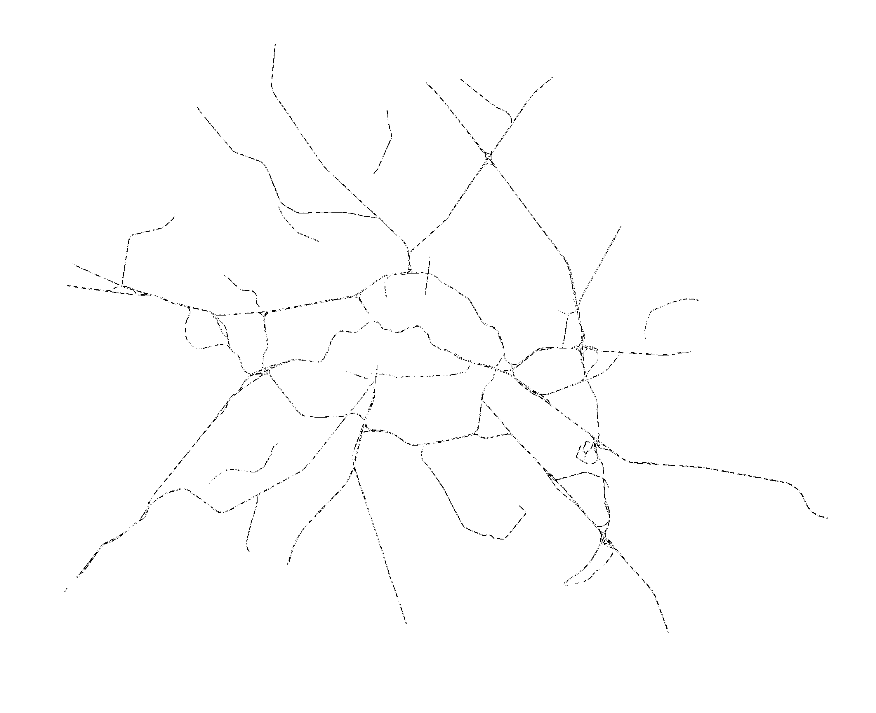
| Gleise (ID: 3) | |
| Show Layer on Map | |
| Download | Moabit Karte Berlin Karte |
| Abstract | Darstellung des Gleisnetzes von Berlin |
| MetaData | http://fbinter.stadt-berlin.de/fb/csw?REQUEST=GetRecordById&SERVICE=CSW&VERSION=2.0.2&ID=52b39467-eb2a-3a0a-ae8a-2e34626745aa&ELEMENTSETNAME=FULL |
| GDI ID | undefined |
| Style | Standard GDI Style (gdi_default) |
| Legend | http://fbinter.stadt-berlin.de/fb/wms/legend/senstadt/k_fb_berlinbtk?layerID=3 (300x300) |
| ScaleHint | 0-499 |
| Keywords | inspireidentifiziert,Karten,Geodaten,Berlin,Biotope,Biotopkartierung,Biotoptypenkartierung,Biotoptypenliste,Biotopwert,Biotopschutz,FFH,Lebensraumtypen,Naturhaushalt,Landschaft,Wälder,Forsten,Stadtgrün,wertvolle Lebensräume |
| BoundingBox | EPSG:25833 (5798934.3364,367190.9604,5838875.0218,417447.1434) |
| BoundingBox | EPSG:3068 (-149.9899,850.0092,40750.01,50350.0091) |
| BoundingBox | EPSG:31467 (5806761.9082,3776226.1598,5850798.2686,3823055.1387) |
| BoundingBox | EPSG:25832 (5804876.2202,776043.3892,5848894.474,822854.0551) |
| BoundingBox | EPSG:4258 (52.3246,13.0512,52.6935,13.7785) |
| BoundingBox | EPSG:4326 (52.3246,13.0512,52.6935,13.7785) |
| Grenzen Biotoptypen (ID: 6) | |
| Show Layer on Map | |
| Download | Moabit Karte Berlin Karte |
| Abstract | Abgrenzungen der Biotope |
| MetaData | http://fbinter.stadt-berlin.de/fb/csw?REQUEST=GetRecordById&SERVICE=CSW&VERSION=2.0.2&ID=52b39467-eb2a-3a0a-ae8a-2e34626745aa&ELEMENTSETNAME=FULL |
| GDI ID | undefined |
| Style | Standard GDI Style (gdi_default) |
| Legend | http://fbinter.stadt-berlin.de/fb_daten/legenden/umweltatlas/leg_fb_berlinbtk.gif (72x72) |
| ScaleHint | 0-5 |
| Keywords | inspireidentifiziert,Karten,Geodaten,Berlin,Biotope,Biotopkartierung,Biotoptypenkartierung,Biotoptypenliste,Biotopwert,Biotopschutz,FFH,Lebensraumtypen,Naturhaushalt,Landschaft,Wälder,Forsten,Stadtgrün,wertvolle Lebensräume |
| BoundingBox | EPSG:25833 (5798934.3364,367190.9604,5838875.0218,417447.1434) |
| BoundingBox | EPSG:3068 (-149.9899,850.0092,40750.01,50350.0091) |
| BoundingBox | EPSG:31467 (5806761.9082,3776226.1598,5850798.2686,3823055.1387) |
| BoundingBox | EPSG:25832 (5804876.2202,776043.3892,5848894.474,822854.0551) |
| BoundingBox | EPSG:4258 (52.3246,13.0512,52.6935,13.7785) |
| BoundingBox | EPSG:4326 (52.3246,13.0512,52.6935,13.7785) |
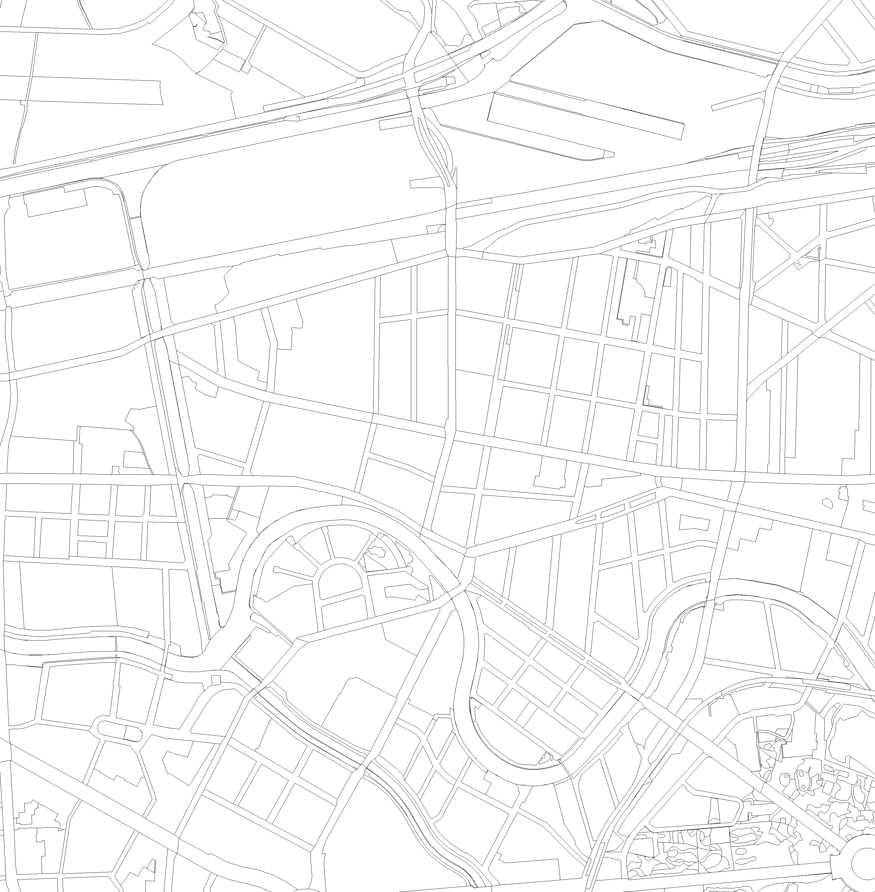
| K5 (ID: 7) | |
| Show Layer on Map | |
| Download | Moabit Karte Berlin Karte |
| Abstract | Karte von Berlin 1:5000 |
| MetaData | http://fbinter.stadt-berlin.de/fb/csw?REQUEST=GetRecordById&SERVICE=CSW&VERSION=2.0.2&ID=52b39467-eb2a-3a0a-ae8a-2e34626745aa&ELEMENTSETNAME=FULL |
| GDI ID | undefined |
| Style | Standard GDI Style (gdi_default) |
| Legend | http://fbinter.stadt-berlin.de/fb/wms/legend/senstadt/k_fb_berlinbtk?layerID=7 (300x300) |
| ScaleHint | 0-7 |
| Keywords | inspireidentifiziert,Karten,Geodaten,Berlin,Biotope,Biotopkartierung,Biotoptypenkartierung,Biotoptypenliste,Biotopwert,Biotopschutz,FFH,Lebensraumtypen,Naturhaushalt,Landschaft,Wälder,Forsten,Stadtgrün,wertvolle Lebensräume |
| BoundingBox | EPSG:25833 (5798934.3364,367190.9604,5838875.0218,417447.1434) |
| BoundingBox | EPSG:3068 (-149.9899,850.0092,40750.01,50350.0091) |
| BoundingBox | EPSG:31467 (5806761.9082,3776226.1598,5850798.2686,3823055.1387) |
| BoundingBox | EPSG:25832 (5804876.2202,776043.3892,5848894.474,822854.0551) |
| BoundingBox | EPSG:4258 (52.3246,13.0512,52.6935,13.7785) |
| BoundingBox | EPSG:4326 (52.3246,13.0512,52.6935,13.7785) |
| ALK (ID: 8) | |
| Show Layer on Map | |
| Download | Moabit Karte Berlin Karte |
| Abstract | Automatisierte Liegenschaftskarte |
| MetaData | http://fbinter.stadt-berlin.de/fb/csw?REQUEST=GetRecordById&SERVICE=CSW&VERSION=2.0.2&ID=52b39467-eb2a-3a0a-ae8a-2e34626745aa&ELEMENTSETNAME=FULL |
| GDI ID | undefined |
| Style | Standard GDI Style (gdi_default) |
| Legend | http://fbinter.stadt-berlin.de/fb/wms/legend/senstadt/k_fb_berlinbtk?layerID=8 (300x300) |
| ScaleHint | 0-2 |
| Keywords | inspireidentifiziert,Karten,Geodaten,Berlin,Biotope,Biotopkartierung,Biotoptypenkartierung,Biotoptypenliste,Biotopwert,Biotopschutz,FFH,Lebensraumtypen,Naturhaushalt,Landschaft,Wälder,Forsten,Stadtgrün,wertvolle Lebensräume |
| BoundingBox | EPSG:25833 (5798934.3364,367190.9604,5838875.0218,417447.1434) |
| BoundingBox | EPSG:3068 (-149.9899,850.0092,40750.01,50350.0091) |
| BoundingBox | EPSG:31467 (5806761.9082,3776226.1598,5850798.2686,3823055.1387) |
| BoundingBox | EPSG:25832 (5804876.2202,776043.3892,5848894.474,822854.0551) |
| BoundingBox | EPSG:4258 (52.3246,13.0512,52.6935,13.7785) |
| BoundingBox | EPSG:4326 (52.3246,13.0512,52.6935,13.7785) |
| Biotopschlüssel (ID: 4) | |
| Show Layer on Map | |
| Download | Moabit Karte Berlin Karte |
| Abstract | Codierung des Haupt-Biotops nach der Berliner Biotoptypen-Liste, dieses ist der prägende Biotoptyp |
| MetaData | http://fbinter.stadt-berlin.de/fb/csw?REQUEST=GetRecordById&SERVICE=CSW&VERSION=2.0.2&ID=52b39467-eb2a-3a0a-ae8a-2e34626745aa&ELEMENTSETNAME=FULL |
| GDI ID | undefined |
| Style | Standard GDI Style (gdi_default) |
| Legend | http://fbinter.stadt-berlin.de/fb_daten/legenden/umweltatlas/leg_fb_berlinbtk.gif (72x72) |
| ScaleHint | 0-499 |
| Keywords | inspireidentifiziert,Karten,Geodaten,Berlin,Biotope,Biotopkartierung,Biotoptypenkartierung,Biotoptypenliste,Biotopwert,Biotopschutz,FFH,Lebensraumtypen,Naturhaushalt,Landschaft,Wälder,Forsten,Stadtgrün,wertvolle Lebensräume |
| BoundingBox | EPSG:25833 (5798934.3364,367190.9604,5838875.0218,417447.1434) |
| BoundingBox | EPSG:3068 (-149.9899,850.0092,40750.01,50350.0091) |
| BoundingBox | EPSG:31467 (5806761.9082,3776226.1598,5850798.2686,3823055.1387) |
| BoundingBox | EPSG:25832 (5804876.2202,776043.3892,5848894.474,822854.0551) |
| BoundingBox | EPSG:4258 (52.3246,13.0512,52.6935,13.7785) |
| BoundingBox | EPSG:4326 (52.3246,13.0512,52.6935,13.7785) |
| BfN-Schlüssel (ID: 5) | |
| Show Layer on Map | |
| Download | Moabit Karte Berlin Karte |
| Abstract | Biotop-Code des Bundes |
| MetaData | http://fbinter.stadt-berlin.de/fb/csw?REQUEST=GetRecordById&SERVICE=CSW&VERSION=2.0.2&ID=52b39467-eb2a-3a0a-ae8a-2e34626745aa&ELEMENTSETNAME=FULL |
| GDI ID | undefined |
| Style | Standard GDI Style (gdi_default) |
| Legend | http://fbinter.stadt-berlin.de/fb/wms/legend/senstadt/k_fb_berlinbtk?layerID=5 (300x300) |
| ScaleHint | 0-499 |
| Keywords | inspireidentifiziert,Karten,Geodaten,Berlin,Biotope,Biotopkartierung,Biotoptypenkartierung,Biotoptypenliste,Biotopwert,Biotopschutz,FFH,Lebensraumtypen,Naturhaushalt,Landschaft,Wälder,Forsten,Stadtgrün,wertvolle Lebensräume |
| BoundingBox | EPSG:25833 (5798934.3364,367190.9604,5838875.0218,417447.1434) |
| BoundingBox | EPSG:3068 (-149.9899,850.0092,40750.01,50350.0091) |
| BoundingBox | EPSG:31467 (5806761.9082,3776226.1598,5850798.2686,3823055.1387) |
| BoundingBox | EPSG:25832 (5804876.2202,776043.3892,5848894.474,822854.0551) |
| BoundingBox | EPSG:4258 (52.3246,13.0512,52.6935,13.7785) |
| BoundingBox | EPSG:4326 (52.3246,13.0512,52.6935,13.7785) |
