Humusmenge der Böden 2005 (Umweltatlas)
| Type | wms |
|---|---|
| Title | Humusmenge der Böden 2005 (Umweltatlas) |
| Category | Umweltatlas |
| Download | See individual layer for download link. |
| FisBroker-Link | http://fbinter.stadt-berlin.de/fb/index.jsp?loginkey=showMap&mapId=k01_06_05humus2005@senstadt |
| Keywords | Boden,Soil,Karten,Geodaten,Berlin,Umweltatlas |
| Beschreibung | |
| link | ?id=k01_06_05humus2005@senstadt&type=WMS |
| kurzbeschreibung | Darstellung der Humusmenge der Böden auf Block- und Blockteilflächen-Basis, 1:5 000, Stand 2005. |
| koordinatensysteme | EPSG:3068, EPSG:25833 |
| ausdehnung | EPSG:3068: 850, -150, 50350, 40750 EPSG:25833: 367190,96, 5798934,34, 417447,14, 5838875,02 |
| ebenen | Humusmenge Hintergrund ISU 5 2005 Bezirksname Gleise aus K5 |
| nutzungsbedingungen | Für die Verwendung der Daten gelten folgende Nutzungsbestimmungen: http://www.stadtentwicklung.berlin.de/geoinformation/download/nutzIII.pdf. Der Quellenvermerk, der gemäß §2 der o.g. Nutzungsbestimmungen zu verwenden ist, lautet "Umweltatlas Berlin / [Titel des Datensatzes]". |
| zugriffsbeschränkungen | Es gelten keine Bedingungen |
| beschreibung | Darstellung der Humusmenge der Böden auf Block- und Blockteilflächen-Basis, 1:5 000, Stand 2005. |
| Anbieter | |
| Adress | Senatsverwaltung für Stadtentwicklung und Umwelt Berlin Berlin Fehrbelliner Platz 1, 10707 Berlin |
| telefon | +49-30-90139-5257 |
| fax | +49-30-90139-5251 |
| fisbroker@senstadtum.berlin.de | |
| Technology | |
| standard | WMS |
| version | 1.0.0 1.1.0 1.1.1 1.3.0 |
| operationen | GetCapabilities GetMap GetFeatureInfo |
| grafikformate | image/jpeg image/png |
| rechneradresse | http://fbinter.stadt-berlin.de/fb/wms/senstadt/k01_06_05humus2005 |
| legend | |
| Layers | |
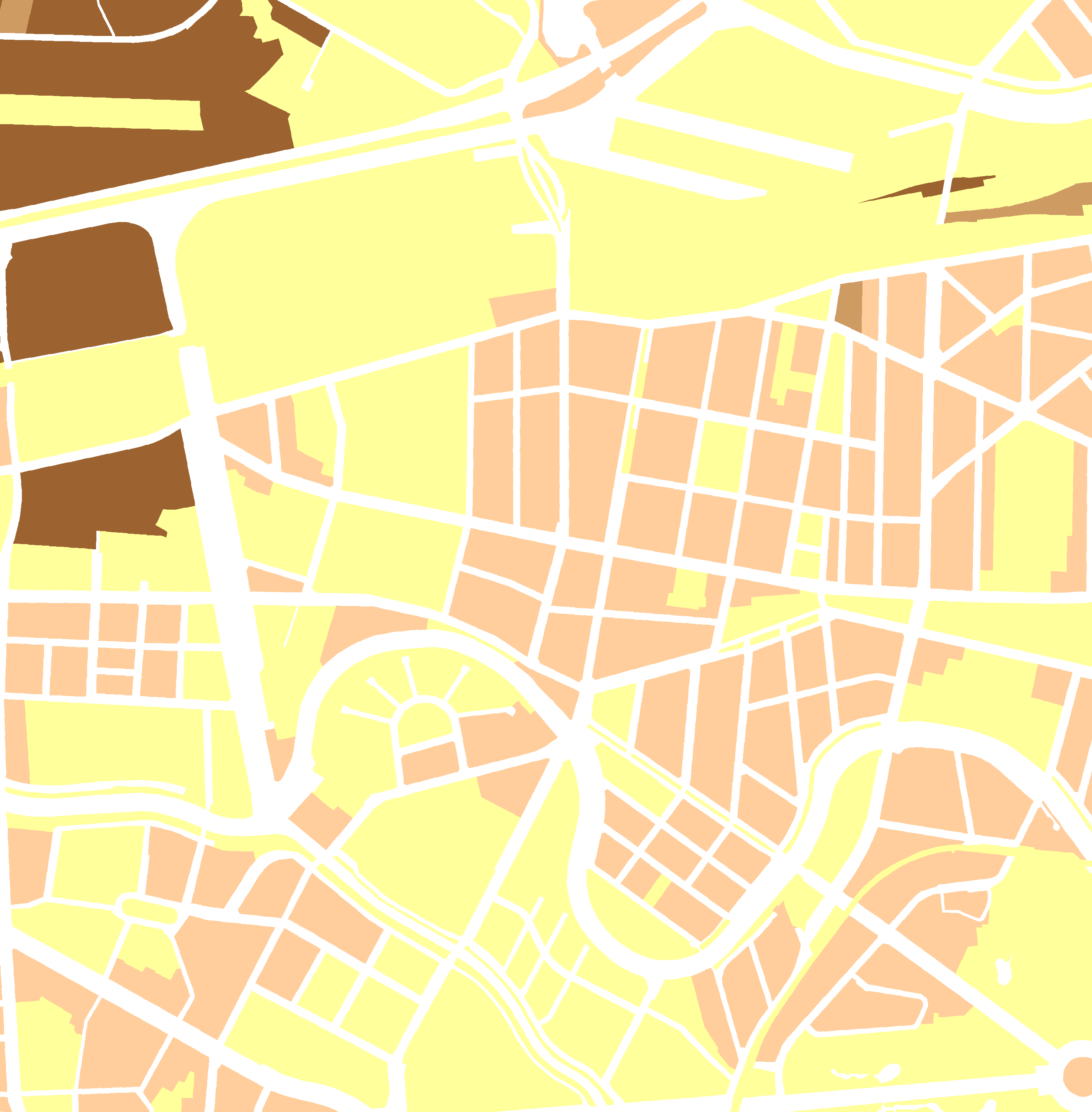
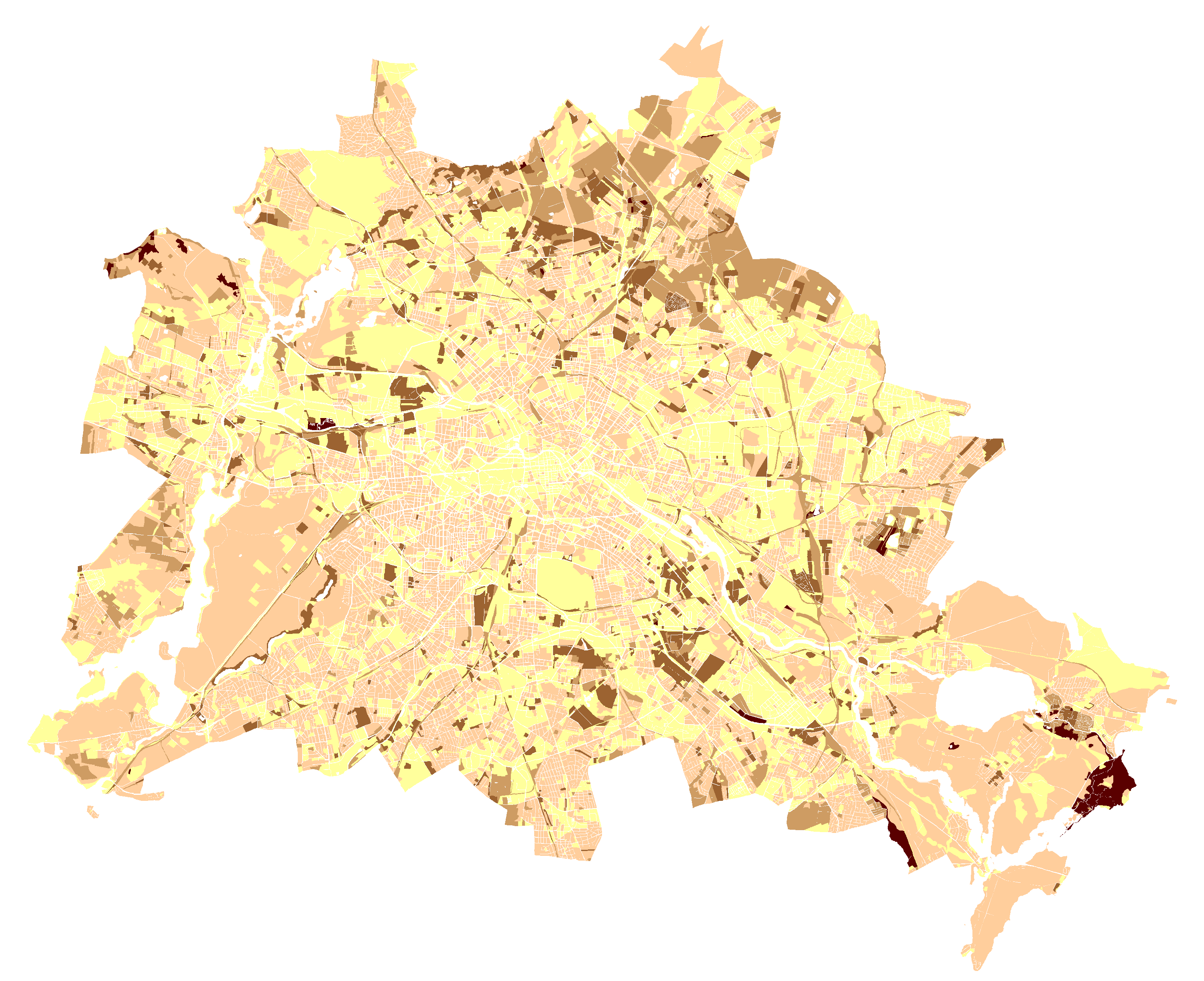
| Humusmenge (ID: 0) | |
| Show Layer on Map | |
| Download | Moabit Karte Berlin Karte |
| Abstract | Humusmenge |
| MetaData | http://fbinter.stadt-berlin.de/fb/csw?REQUEST=GetRecordById&SERVICE=CSW&VERSION=2.0.2&ID=e38f5045-b1e7-31ee-a6e2-9516d22e8158&ELEMENTSETNAME=FULL |
| GDI ID | undefined |
| Style | Standard GDI Style (gdi_default) |
| Legend | http://fbinter.stadt-berlin.de/fb_daten/legenden/umweltatlas/leg_01_06_05humus2006.gif (72x72) |
| ScaleHint | 0-105 |
| Keywords | Karten,Geodaten,Berlin,Umweltatlas |
| BoundingBox | EPSG:3068 (-150,850,40750,50350) |
| BoundingBox | EPSG:25833 (5798934.3364,367190.9604,5838875.0218,417447.1434) |
| BoundingBox | EPSG:4326 (52.3246,13.0512,52.6935,13.7785) |
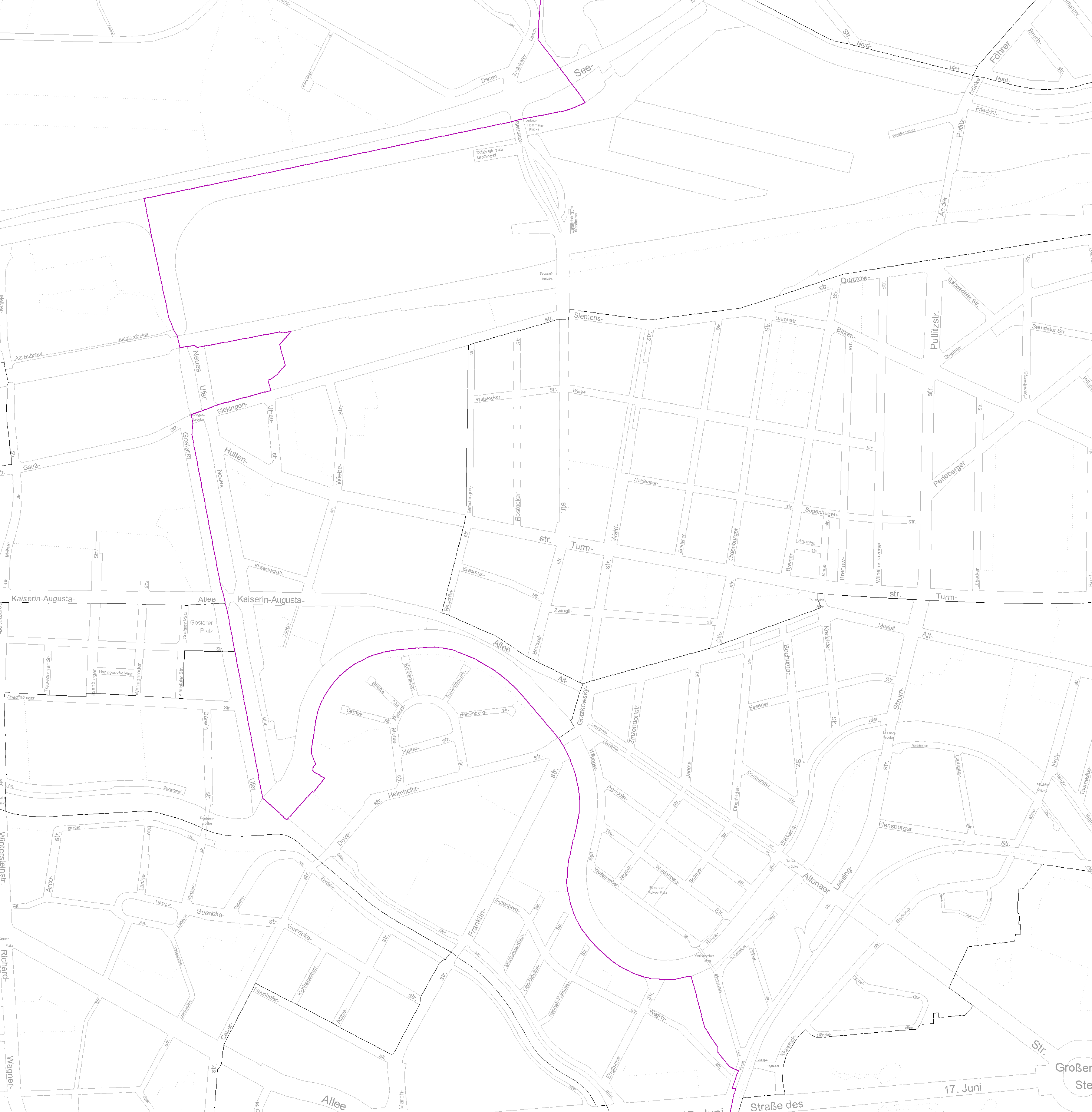
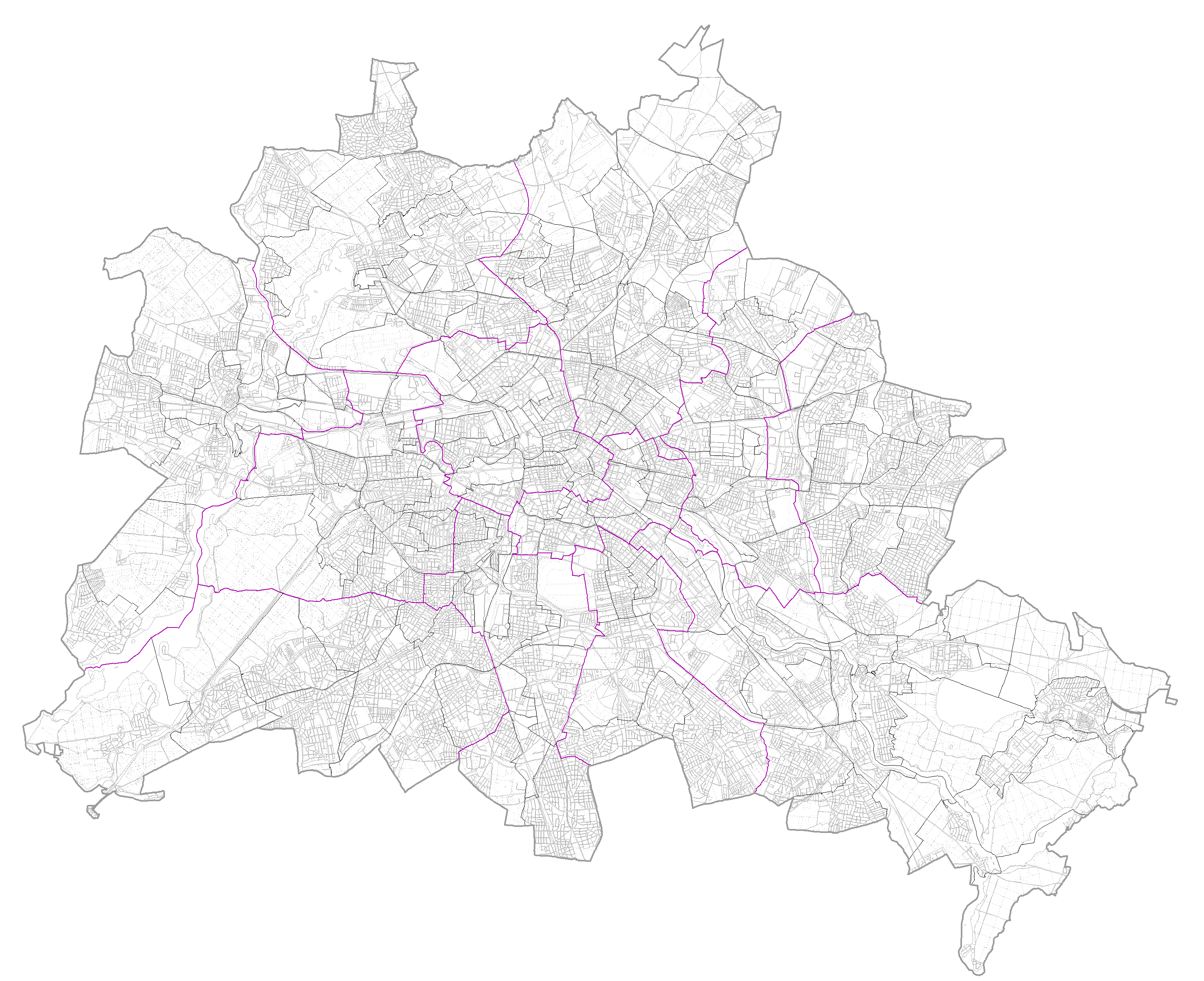
| Hintergrund ISU 5 2005 (ID: 1) | |
| Show Layer on Map | |
| Download | Moabit Karte Berlin Karte |
| Abstract | Blockkarte des ISU, 1:5.000 (ISU5), Stand 2005 |
| MetaData | http://fbinter.stadt-berlin.de/fb/csw?REQUEST=GetRecordById&SERVICE=CSW&VERSION=2.0.2&ID=e38f5045-b1e7-31ee-a6e2-9516d22e8158&ELEMENTSETNAME=FULL |
| GDI ID | undefined |
| Style | Standard GDI Style (gdi_default) |
| Legend | http://fbinter.stadt-berlin.de/fb/wms/legend/senstadt/k01_06_05humus2005?layerID=1 (300x300) |
| ScaleHint | 0-105 |
| Keywords | Karten,Geodaten,Berlin,Umweltatlas |
| BoundingBox | EPSG:3068 (-150,850,40750,50350) |
| BoundingBox | EPSG:25833 (5798934.3364,367190.9604,5838875.0218,417447.1434) |
| BoundingBox | EPSG:4326 (52.3246,13.0512,52.6935,13.7785) |
| Bezirksname (ID: 2) | |
| Show Layer on Map | |
| Download | Moabit Karte Berlin Karte |
| Abstract | Bezirksnamen aus der Blockkarte des ISU, 1:5.000 (ISU5), Stand 2005 |
| MetaData | http://fbinter.stadt-berlin.de/fb/csw?REQUEST=GetRecordById&SERVICE=CSW&VERSION=2.0.2&ID=e38f5045-b1e7-31ee-a6e2-9516d22e8158&ELEMENTSETNAME=FULL |
| GDI ID | undefined |
| Style | Standard GDI Style (gdi_default) |
| Legend | http://fbinter.stadt-berlin.de/fb/wms/legend/senstadt/k01_06_05humus2005?layerID=2 (300x300) |
| ScaleHint | 3-105 |
| Keywords | Karten,Geodaten,Berlin,Umweltatlas |
| BoundingBox | EPSG:3068 (-150,850,40750,50350) |
| BoundingBox | EPSG:25833 (5798934.3364,367190.9604,5838875.0218,417447.1434) |
| BoundingBox | EPSG:4326 (52.3246,13.0512,52.6935,13.7785) |
| Gleise aus K5 (ID: 3) | |
| Show Layer on Map | |
| Download | Moabit Karte Berlin Karte |
| Abstract | Gleise aus der Karte von Berlin 1:5000 |
| MetaData | http://fbinter.stadt-berlin.de/fb/csw?REQUEST=GetRecordById&SERVICE=CSW&VERSION=2.0.2&ID=e38f5045-b1e7-31ee-a6e2-9516d22e8158&ELEMENTSETNAME=FULL |
| GDI ID | undefined |
| Style | Standard GDI Style (gdi_default) |
| Legend | http://fbinter.stadt-berlin.de/fb/wms/legend/senstadt/k01_06_05humus2005?layerID=3 (300x300) |
| ScaleHint | 0-105 |
| Keywords | Karten,Geodaten,Berlin,Umweltatlas |
| BoundingBox | EPSG:3068 (-150,850,40750,50350) |
| BoundingBox | EPSG:25833 (5798934.3364,367190.9604,5838875.0218,417447.1434) |
| BoundingBox | EPSG:4326 (52.3246,13.0512,52.6935,13.7785) |
